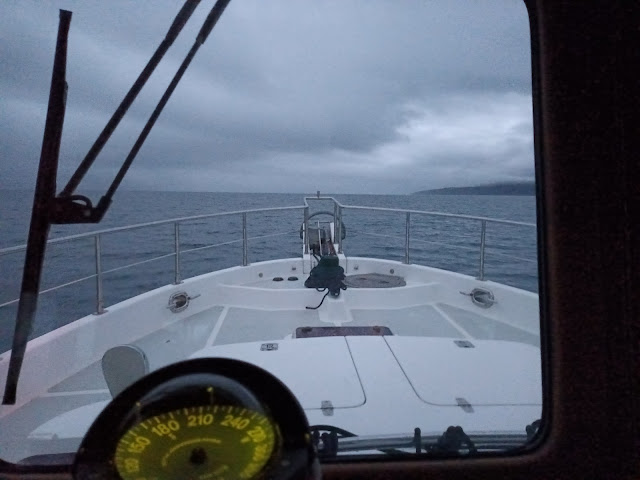
Leaving Stornoway at 1am is not ideal. To be fair, that isn't quite correct. Leaving then is fine, getting up ready to leave at that time is no fun at all. The FLIR lets you see what is about on the water nearby. The radar spots other craft and the plotters are good at hinting where to go next. As this was the longest day, there was not too much pitch darkness anyway. By 3am you could see well enough to switch off the FLIR and stay focussed on the sea, looking for the many pot markers and the radar for other floating things that didn't have their AIS switched on:
The number of fishing boats that like to try and hide their activity by turning off their AIS broadcasts is always a surprise. Such a shame that even when some more daylight peeked through, things were still grey and gloomy:
The beginning of the run was pretty much straight into the wind but with the tide against us it wasn't too bumpy. The forecast had it calming down and sure enough it did just that. By breakfast time it was most benign out to sea:
Oh yes, the forecasts were spot on and the wind changed from 25 plus knots on the nose to under 5 on the beam, The sea behaved as it should and settled down nicely so we enjoyed a quiet ride. Here is the route - around 75 nautical miles, tracking down the east side of the Outer Hebrides islands, admiring Skye off to port for a while and then to South Uist:
You can see on this track captured from Marinetraffic.com that there are a few missing arrows. They pick up our AIS broadcasts via shore station folks who have aerials and computer kit connected up to the internet to send the data to Marinetraffic. There are few houses on the shore in the area where the track becomes "empty" and so no equipment was there to report our position / date / times. We are too mean to subscribe to the Marinetraffic satellite service where they track you from space, that might have filled in the gaps.
Off Skye, there is a traffic separation zone:
You can see the arrows and the "lanes" showing where the big guys should be going north or south around Skye. A strange looking workboat passed us heading north and then we heard them being called by the Stornoway coastguard. Nitrox was not the prettiest thing afloat (here is a picture from Marinetraffic):
and they ended up in deep trouble with the coastguard for not following the correct lane in the TSS when heading north. They were told to "record this conversation in the ship's log as a report will be filed". The closest you get on the marine radio to someone being yelled at for being a numpty. We do wonder what the captain was thinking and what happened once the report was made.
As we approached South Uist, the clouds thinned and life got brighter:
You can see how intent Patrick and Polly were, observing the crew fixing the fenders and lines for our arrival in Lochboisdale:
Patrick seems quite serious about cuddling Polly too. Despite his advancing years he seems hopeful.
The Marinetraffic AIS track died just off Lochboisdale too. This is where they thought we ended up:
and clearly we would not have needed fenders and mooring lines there, just an anchor and lots and lots of chain.
We were given a lovely alongside berth in the harbour, helped with our lines by the harbourmaster and a bertholder and happily settled in. The trip took 12 hours and went rather well. We gave the wing engine a good run as we approached the harbour to keep it happy and a good wide open throttle run for the main engine to give it a clean out after 12 hours at around 40% of maximum output.
The area around the harbour is not bad at all:


No comments:
Post a Comment
Thanks for your ideas / cheek / corrections / whatever! They should hit the blog shortly after the system checks them to make sure they will not put us or you in jail.....